Making Maps using ArcGIS Pro
December 10th, 2022
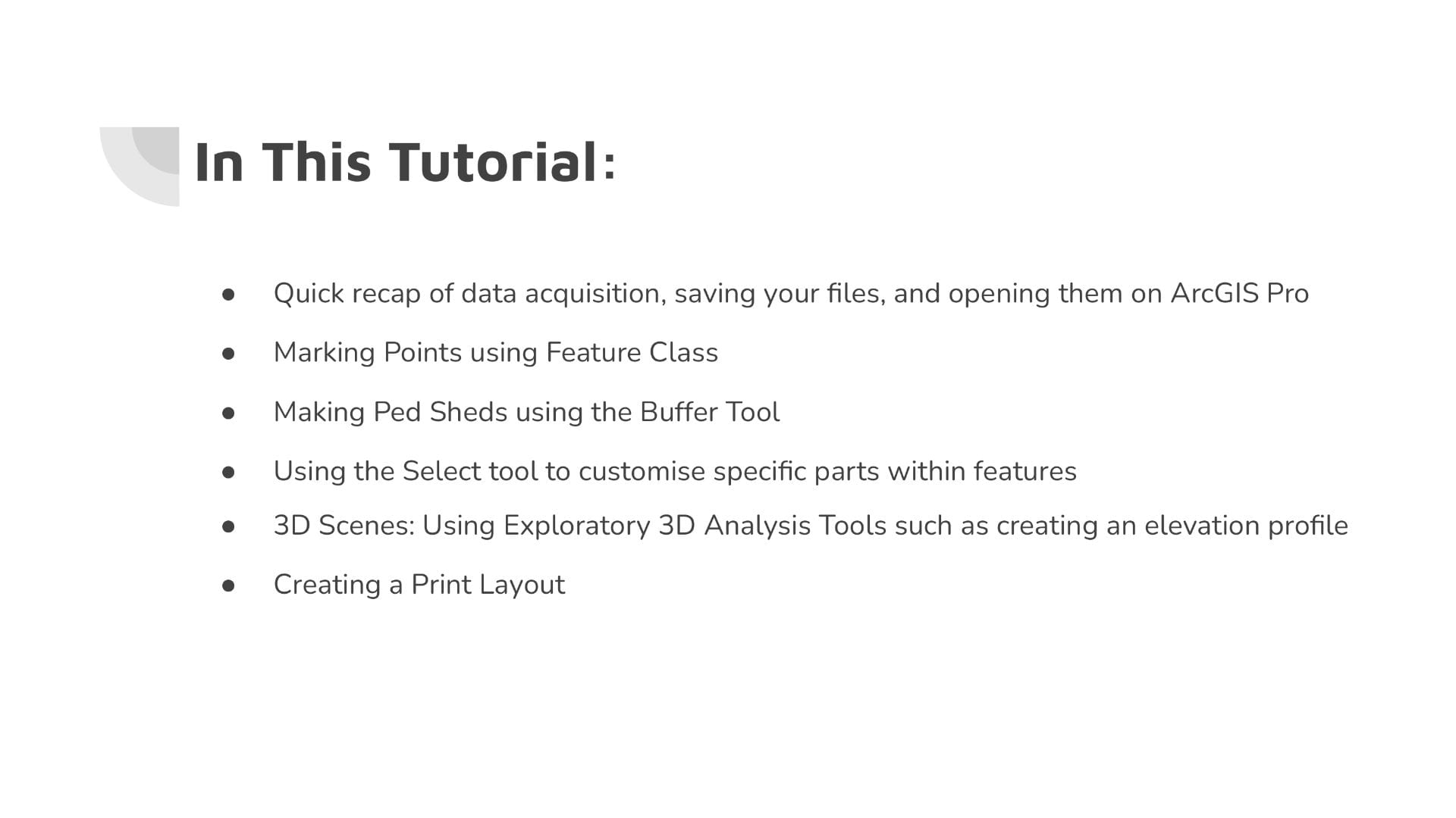
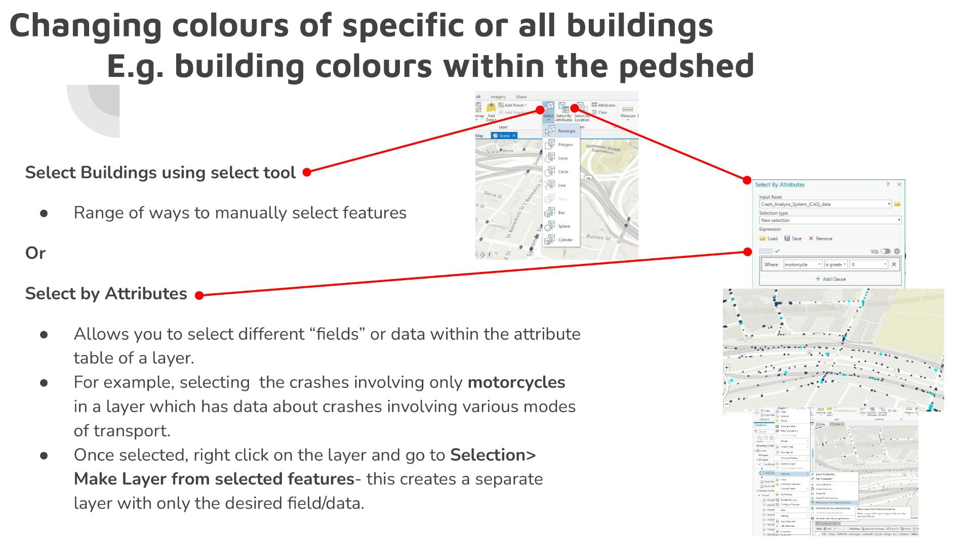
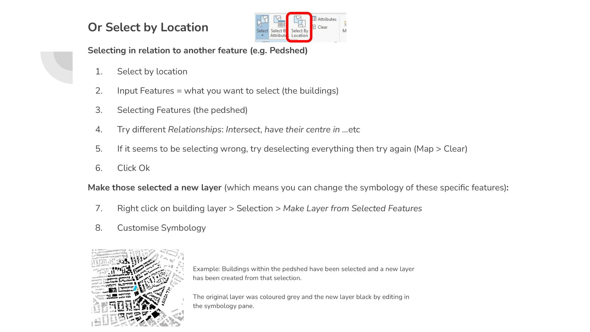
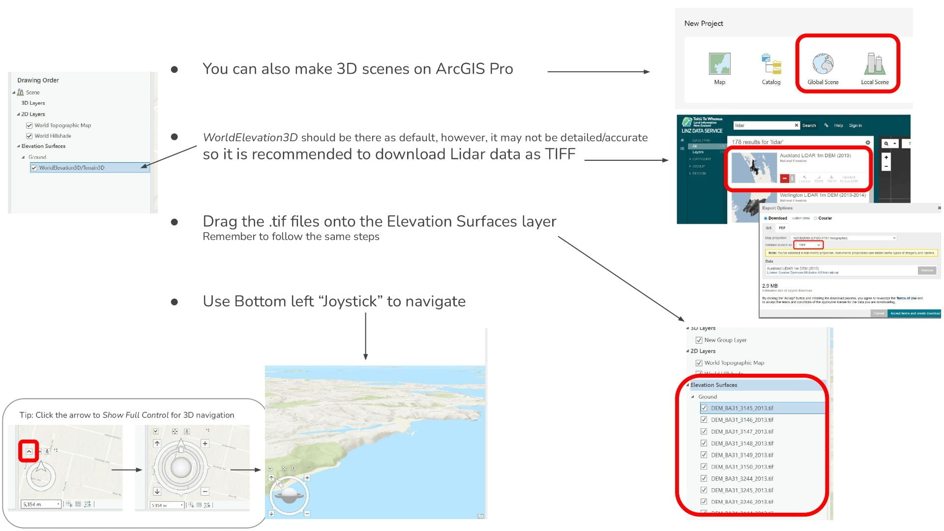
This Tutorial includes: Quick recap of data acquisition, saving your files, and opening them on ArcGIS Pro, Marking Points using Feature Class, Making, Ped Sheds using the Buffer Tool, Using the Select tool to customise specific parts within features, 3D Scenes: Using Exploratory 3D Analysis Tools such as creating an elevation profile, Creating a Print Layout